

Matsusaka Kahada Gorge i sierra
#Chunansei(Matsusaka City)
Matsuzaka Kouhakikyo
The upper reaches of the Kushida River, which runs along the Median Tectonic Line, is known as the Kaohada Gorge Prefectural Natural Park, and boasts of its beautiful valleys. The area from Akakoe to Miyamae is called "Kabada Nagatoro," and river rafting is the best way to experience its beauty. The horseshoe-shaped mountain ranges surrounding the gorge can all be climbed, but Takami-yama, Sanbong-yama, Keikodake, and Shiroi-yama, located on the northern side of the gorge, are popular spots for day trips. The views from the top of the mountain are wonderful. Historically, it is located in the middle of Wakayama Kaido (Ise Kaido), which connects Ise and Yamato, and has been a place where the cultures of Ise and Yamato intersected since ancient times. A leisurely bicycle ride along the old highway will give you a sense of the history and lifestyle of the area.
PICK UP CONTENTS
Recommended Content
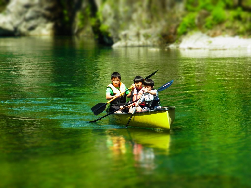
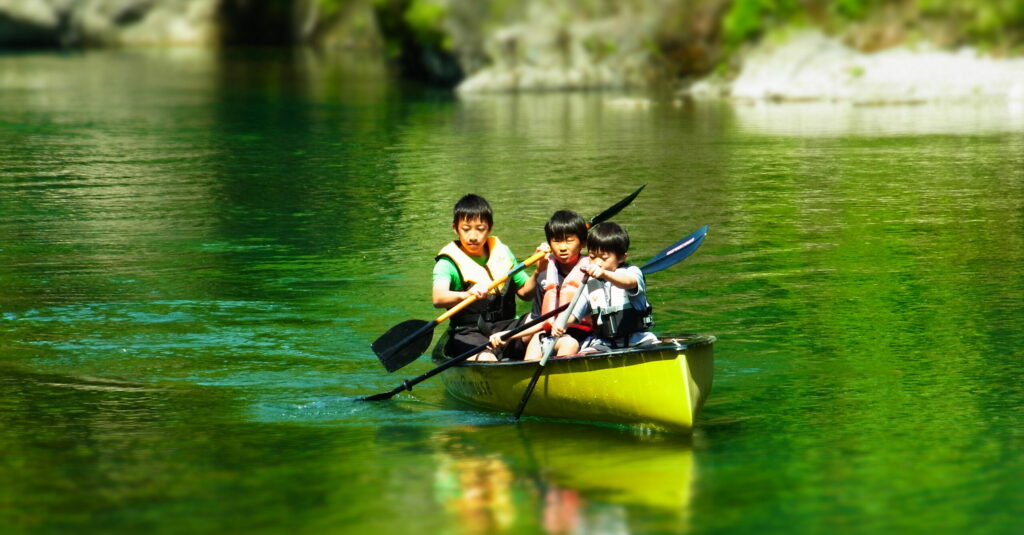
A beautiful river that once became the clearest river in Japan.
The Kushida River is the best canoeing slope in Mie Prefecture and is a beautiful river that has once been ranked the clearest river in Japan. This is a fun canoeing experience for beginners and families, where you can enjoy the river safely and with peace of mind wearing a life jacket. You can also enjoy river rafting with a highly buoyant packraft or ducky.
Facility Information
Matsusaka Kahada Gorge i sierra
Location:
〒515-1501 1569 Shimotakino, Iitaka-cho, Matsusaka City, Mie Prefecture
Phone number:080-3630-4396
Access and local transportation
From JR/Kintetsu Matsusaka Station (approx. 1 hour) Matsusaka Station West Exit (Omote) Bus Terminal #4 → "Roadside Station Iitaka Station" bus stop * Destination: Mie Kotsu Bus bound for "Roadside Station Iitaka Station" or "Hotel Sumeru" from Nagoya - Ise Expressway Matsusaka IC (approx. 30 km) Matsusaka IC Prefectural Road 59 → Turn right on National Road 166 Travel time: Approx. 40 minutes from Matsusaka IC
From Osaka/Nara - Meihan National Highway, approx. 65 km from Hari IC → Route 369 → Route 370 → Turn left on Route 166 Travel time: approx. 90 minutes from Hari IC
Other Recommendations
Inosan Farm
You can work outdoors on a sunny day at a farm in Yamanouye, surrounded by nature…
Chunansei(Tsu City)
Verde Otai Tourism
Verde means "green" in Spanish. We offer a variety of attractive outdoor events s…
Chunansei(Taki Town)
Guesthouse Ilongo
This is a farmhouse guest house in Hakusan-cho, Tsu City, where you can experienc…
Chunansei(Tsu City)